CITYWORKS PLL
Empowering GIS intelligence for permits, licensing, and land.
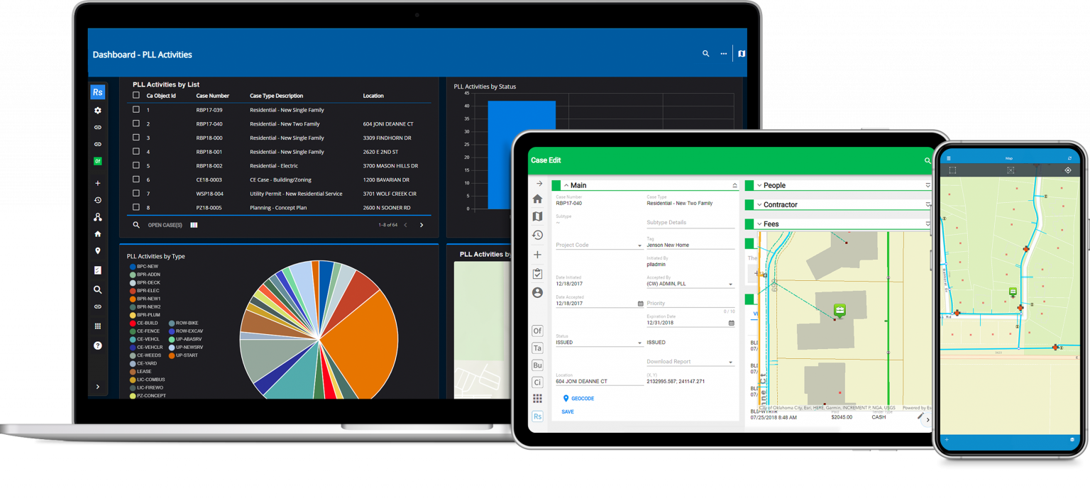
Cityworks PLL is the leading GIS-centric solution for permitting, licensing, and land management. Designed to simplify applications for customers and streamline workflows for staff, Cityworks helps local governments and utilities track the full life cycle of public assets and achieve greater collaboration across departments.
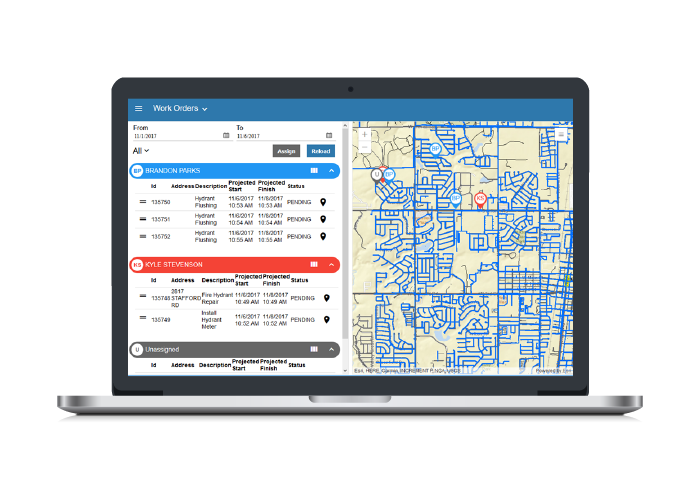
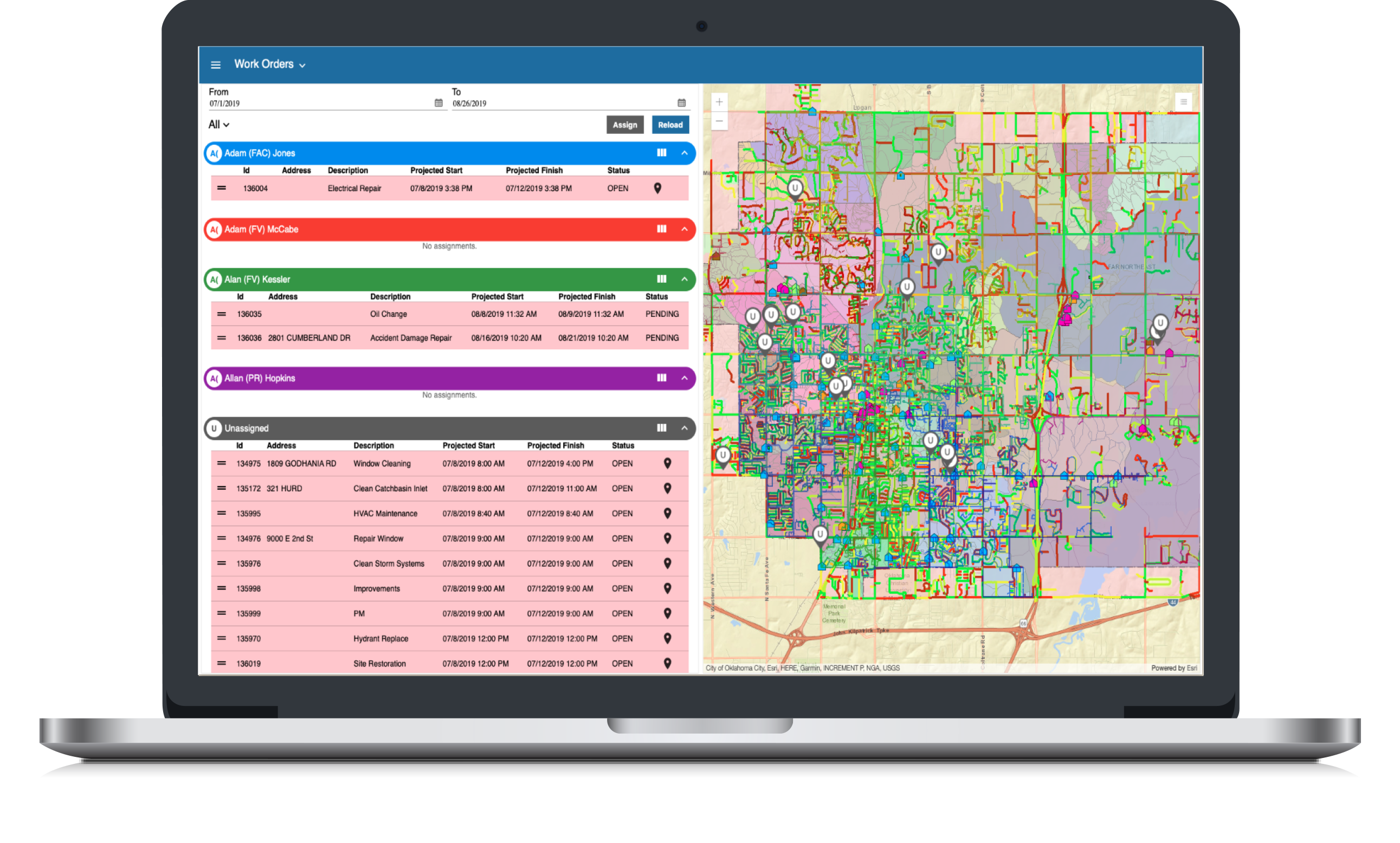
Workload
Take the Work Out of Work Management
For supervisors who manage field crews and inspectors, juggling employee schedules can be a daunting task. Workload gives supervisors a simple yet powerful interface for reviewing, assigning, and modifying work activities. The application includes a dynamic map interface and allows managers to interact with PLL cases as well as AMS work orders and inspections.
Respond
Works Where You Are
Your work isn’t limited to your desk and neither is Cityworks. Cityworks Respond delivers a persistent map experience and powerful dashboards with a modern look and feel—whether you’re on a computer, tablet, or smartphone. You have the power to manage assets and create work orders, as well as capture digital signatures for inspections and permitting tasks, right in the palm of your hand.
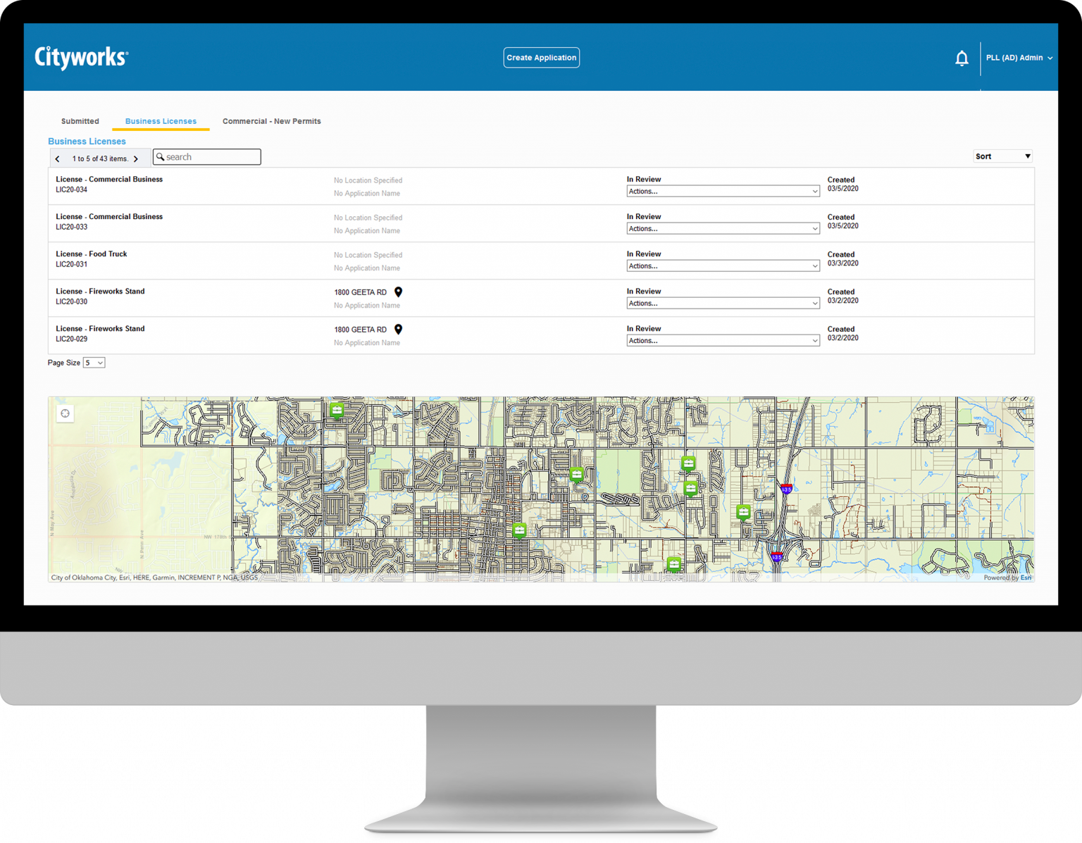
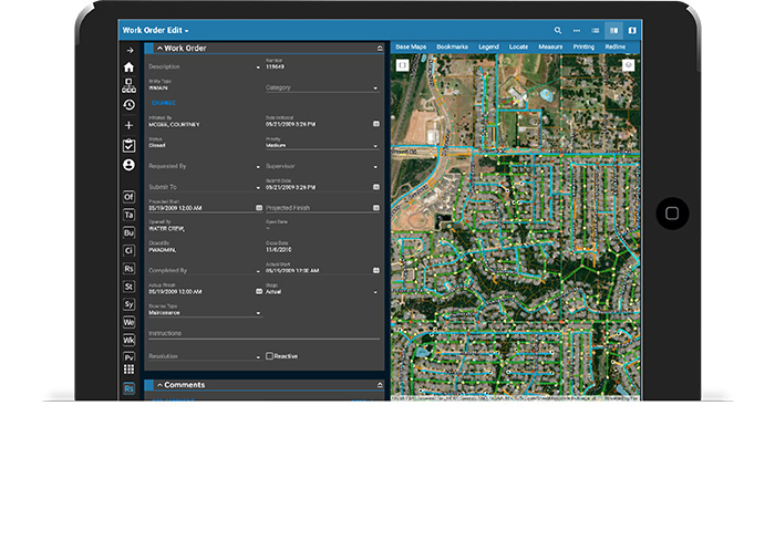
PUBLIC ACCESS
YOUR PORTAL TO BETTER CUSTOMER SERVICE
You need to provide a public-facing, front-end permitting application to help your customers stay connected. Cityworks Public Access replaces traditional counter-based workflows with a GIS-centric public portal for developers, contractors, and residents. Your customers can help you begin the asset lifecycle by applying for permits and licenses, paying fees, scheduling inspections, and more.
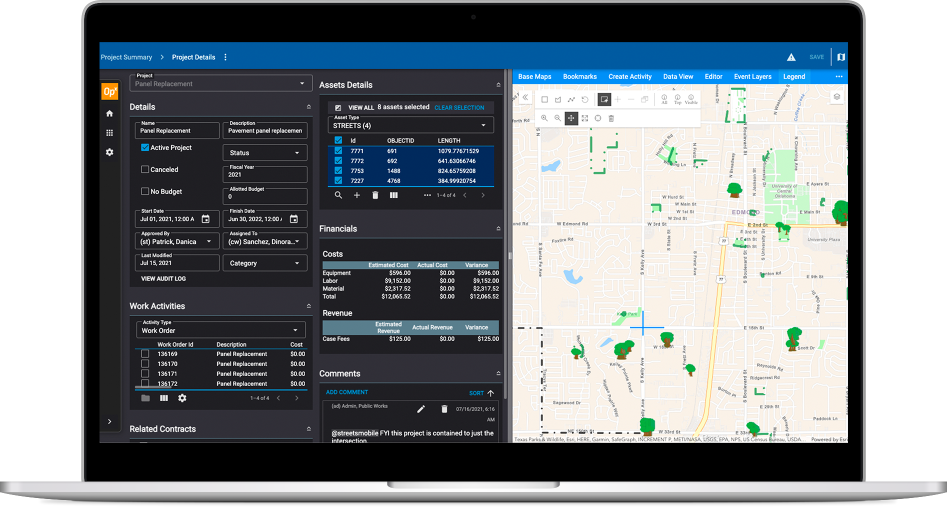
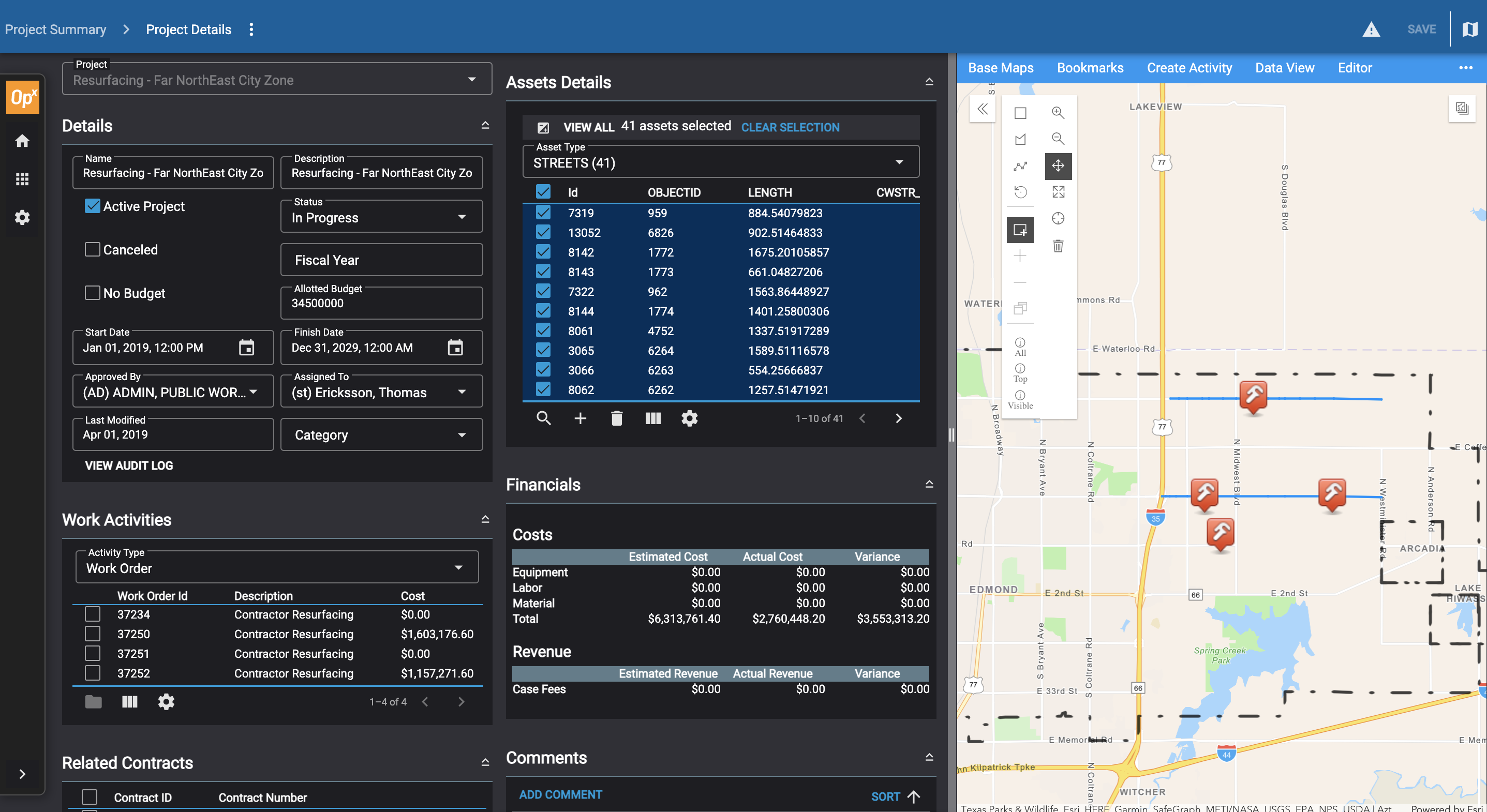
OpX
Create a streamlined experience for operational projects and emergency management.
OpX provides a GIS-centric experience for managing large-scale infrastructure projects and emergency response activities within Cityworks.
CITYWORKS MOBILE APP
Configurable workflows to support you wherever your work takes you.
Give field crews easy access to service requests, work orders, cases, and inspections—right in the palms of their hands. The Cityworks mobile app provides field-specific tools for both iOS and Android devices, eliminating the need for paper forms and supporting valuable data collection.
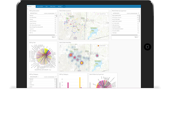
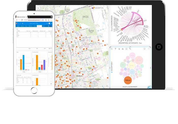
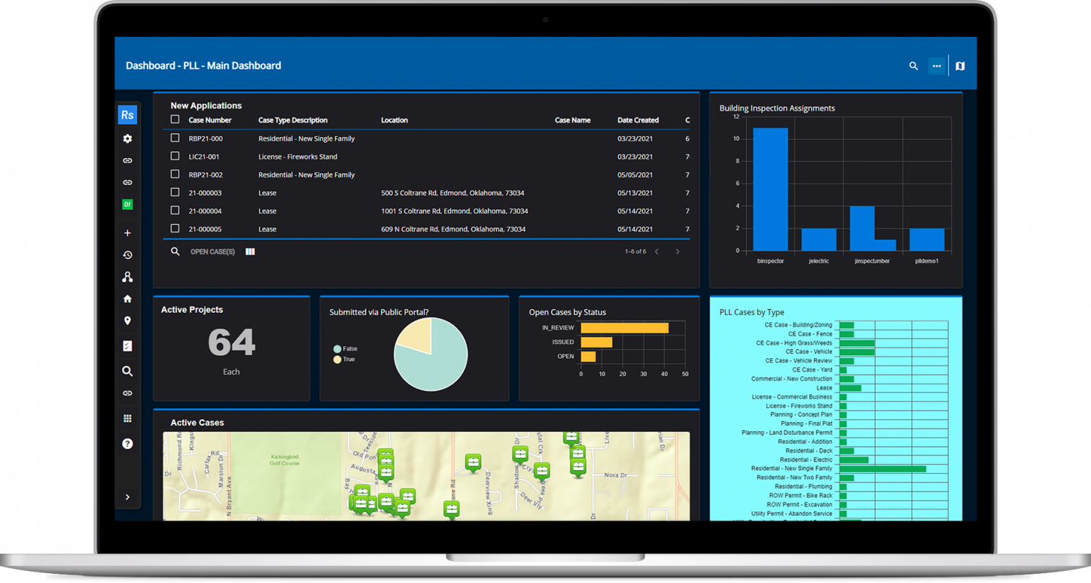
CITYWORKS ANALYTICS
TURN DATA INTO ACTION WITH GIS INTELLIGENCE
Gain insight into your organization’s data and make better decisions with Cityworks Analytics. This robust tool uses Esri’s ArcGIS Insights to analyze the labor, cost, materials, and condition associated with your infrastructure assets. Together, Cityworks Analytics and ArcGIS Insights can help you easily visualize data with simple yet powerful visualizations, from real-time maps to dynamic charts and graphs.